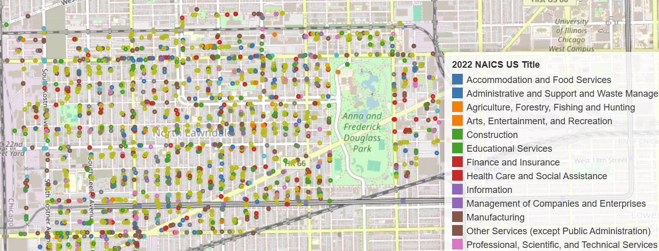
Population Change in North Lawndale - 2012 ACS to 2018-2022 ACS
The Neighborhood of North Lawndale has undergone a population decline over the last decade. How and where is the population declining, where is it staying stable, and where is it growing?
The interactive map below provides population numbers for the neighborhood in 2012 and 2022 based on ACS estimates, allowing users to toggle between the two maps to look at how the underlying census tracts changed over the decade. The 2022 map is colored to help identify areas of population gain (red) and loss (blue) compared to 2012, while the given height of a census tract refers to its current population.
North Lawndale
Map of Population and Population Change (2012-2022) by Census Tract