Lead Water Testing in North Lawndale
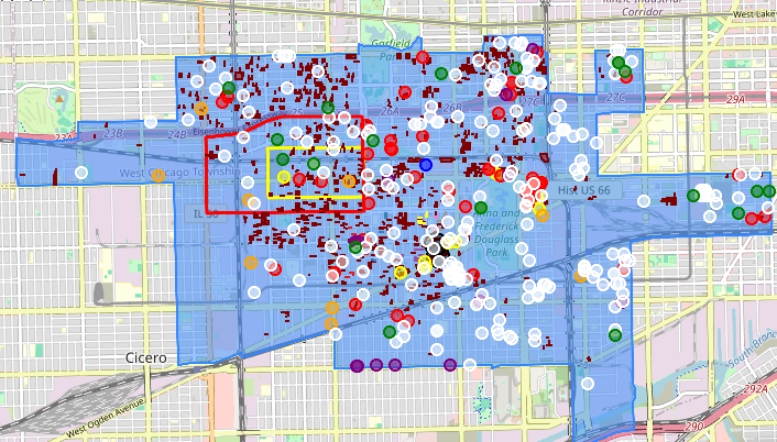
Chicago has a total of 522,571 Service Lines in its Public Water System (PWS). As part of a national survey conducted to determine federal allocation to stat...

Chicago has a total of 522,571 Service Lines in its Public Water System (PWS). As part of a national survey conducted to determine federal allocation to stat...
The following map was created for the purpose of identifying all contiguous vacant parcels (city owned, county owned, privately owned) in North Lawndale that...

North Lawndale - Economic Development Map